What Is Reality Capture?
Reality capture translates physical environments into precise 3D digital models. Learn the core technologies, the scan-to-BIM workflow, and how accurate site data prevents construction rework.
If your project starts with an existing building or site and nobody trusts the drawings, reality capture is how you get measured conditions before design decisions are locked in. Reality capture is the process of generating a digital representation of a physical environment using high-accuracy hardware sensors. This digital twin provides a precise, measurable baseline for design, construction, and facility management. Instead of relying on manual tape measurements or outdated 2D as-built drawings, teams use reality capture to record millions of spatial data points in three dimensions.
What is reality capture?
Reality capture encompasses any technology that records the exact physical conditions of a site or structure to create a digital 3D model. The most common output is a point cloud, which consists of millions of coordinate points that map the geometry of the physical space.
This raw data translates into actionable formats like Autodesk Revit models, AutoCAD DWG layouts, or indexed RCP files. By capturing the existing environment objectively, project teams establish a verified foundation that minimizes the risk of spatial conflicts during subsequent engineering and construction phases. Architects draw from true dimensions rather than estimates, and mechanical engineers route new ductwork based on exact clearances.
What are the core reality capture technologies?
The method of capture depends entirely on the required accuracy, the environment size, and the line-of-sight constraints. We evaluate the specific spatial requirements of a site to deploy the correct instrument.
Terrestrial laser scanning (LiDAR)
Terrestrial laser scanning uses tripod-mounted LiDAR sensors to capture high-density point clouds of static environments. A device like the Leica RTC360 fires millions of laser pulses per second, measuring the time of flight or phase shift to calculate precise distances.
This method delivers an accuracy of ±2 mm at close range, making it the standard for complex indoor environments, mechanical rooms, and dense architectural facades. Because the instrument sits on a fixed tripod, it eliminates motion blur and achieves the highest possible dimensional tolerance. If your project involves a commercial tenant improvement or an MEP retrofit, this is the foundational tool for 3D laser scanning.
Drone photogrammetry and aerial LiDAR
Drone photogrammetry overlaps hundreds of high-resolution aerial photographs to compute 3D geometry, while aerial LiDAR mounts a laser scanner directly onto an unmanned aerial vehicle. Aerial capture covers massive outdoor areas, roof structures, and earthwork sites in a fraction of the time required by ground teams.
A pilot conducting FAA Part 107 compliant operations uses GNSS RTK ground control to tie the aerial data to known geographic coordinates. This ensures the digital model aligns with real-world survey grids. When your project requires mapping broad site topography, calculating earthwork volumes, or inspecting inaccessible roofs, drone surveying and inspection is the correct approach.
Mobile mapping
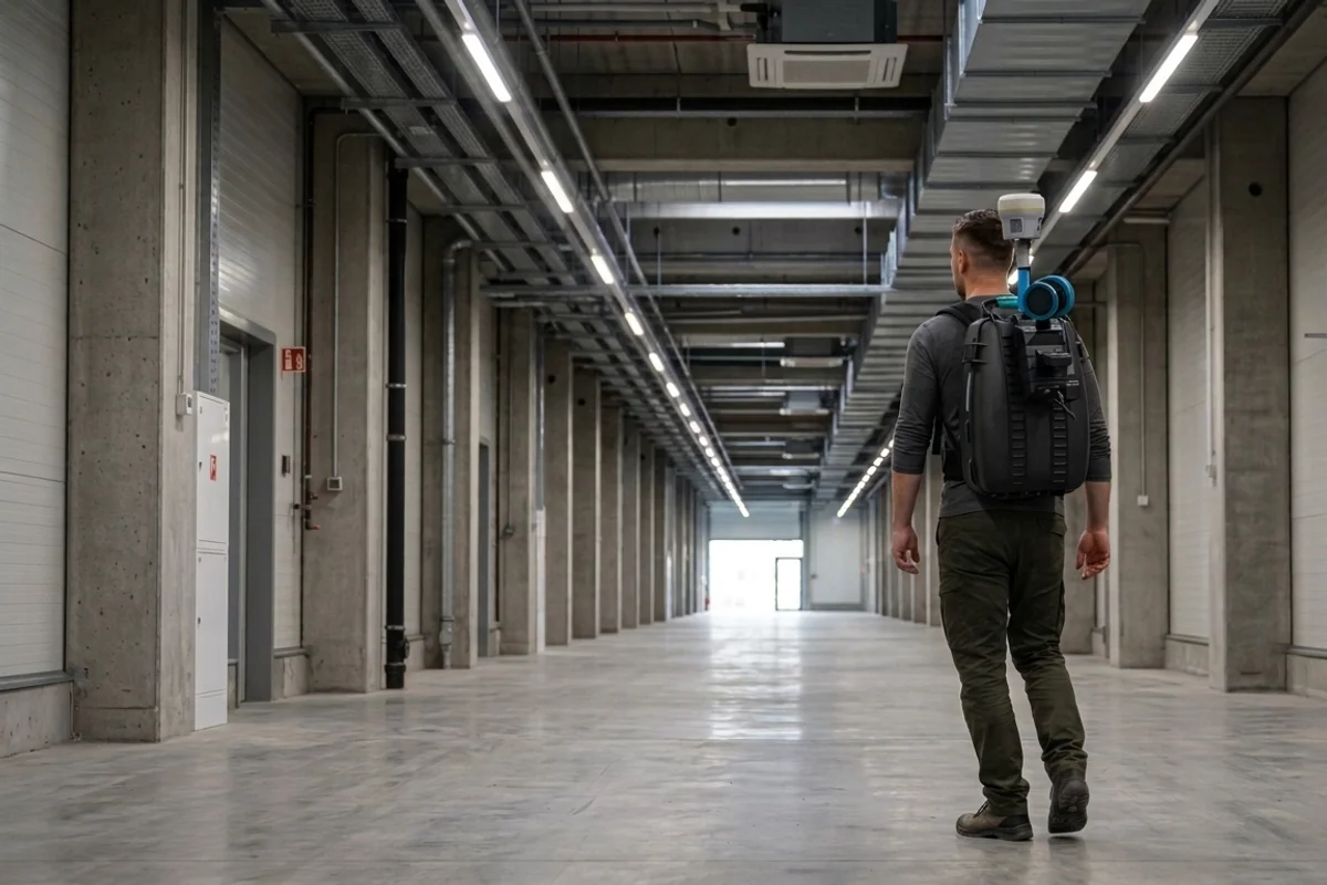
Mobile mapping systems mount LiDAR sensors and 360-degree cameras on backpacks, handheld rigs, or vehicles to capture data while the operator moves through the space.
This approach prioritizes speed over millimeter-level precision. It is effective for documenting long highway corridors, sprawling industrial campuses, or rapid preliminary site walks where capturing the general layout matters more than strict dimensional tolerances. For precise mechanical fabrication, mobile mapping is generally insufficient and must be replaced by terrestrial scanning.
What is the typical reality capture workflow?
The capture process moves from physical field data collection to digital modeling and final file export. The workflow is strictly sequential because the end deliverable relies entirely on the accuracy of the first field measurement.
Field technicians first establish a network of scan stations across the site, ensuring enough overlap between setups to minimize data shadows behind walls or pipes. Once the raw data is collected, the processing team registers the individual scans into a unified coordinate system using software like Cyclone REGISTER 360 PLUS. This registered point cloud is the raw measured truth of the site.
For projects requiring intelligent 3D elements, the workflow advances to scan-to-BIM. Modelers link the indexed RCP or RCS file into Autodesk Revit, tracing the precise geometry to create parametric building elements at Level of Development (LOD) 200 through 500. The final deliverable ranges from a raw E57 file for your own drafters to a fully coordinated native RVT model. Send us your project floor plan, and we will define the most efficient workflow for your required output.
Who uses reality capture data?
Different stakeholders extract different value from the same central point cloud or BIM model. The data serves as a shared reference point across the entire project lifecycle.
Architects use reality capture to generate verified 2D permit sets and 3D design baselines without returning to the site to measure missing structural details. Mechanical, electrical, and plumbing (MEP) engineers rely on the dense point cloud to route new piping through congested plenums without triggering clashes with existing, hidden systems. General contractors deploy reality capture during active construction to verify that newly poured concrete slabs and installed steel framing match the coordinated design model. Facility managers use the final as-built models to locate maintenance access points and manage building assets long after the construction team leaves the site.
How do you choose a reality capture provider?
Selecting a provider requires evaluating their instrument specifications, their software processing pipeline, and their experience with native BIM formats. A firm that only delivers raw E57 files forces your internal team to absorb the massive processing and modeling hours required to make the data usable.
Evaluate the hardware accuracy standard the provider publishes. For indoor mechanical coordination, the equipment must achieve millimeter-level tolerances, such as the ±2 mm accuracy of the Leica RTC360. Confirm that the provider delivers native file formats that match your specific workflow, whether that is an Autodesk Revit model for a hospital retrofit or a 2D AutoCAD DWG for a retail floor plan.
If your project includes exterior modifications that require certified property boundaries, confirm they coordinate with licensed professionals. We serve all of San Diego County, with projects across Orange County, Riverside County and the Inland Empire, providing registered point clouds and native Revit models directly to engineering teams. Certified survey deliverables (boundary, ALTA, stamped topo) are performed by our licensed California Professional Land Surveyor (PLS) partner. Share your building address and required formats, and we will define a precise turnaround schedule for your project deliverables.