Construction Verification Scanning
Construction verification scanning captures active job sites at critical milestones to compare as-built conditions against the coordinated design model, preventing cascading rework.
If an embed, a slab edge, or a duct run goes in a few inches off the coordinated model, finding it before the next trade builds on it costs far less than finding it after. Construction verification scanning captures active job sites at critical milestones to compare as-built conditions against the coordinated design model. It identifies deviations in structural elements, concrete placement, and MEP rough-ins before they cause cascading rework.
Why verify construction progress with a 3D laser scanner?
Visual inspections cannot measure a 1.5-inch (38 mm) deflection in a concrete slab or prove that a newly installed duct run matches the coordinated Navisworks model. Verification scanning provides objective spatial data.
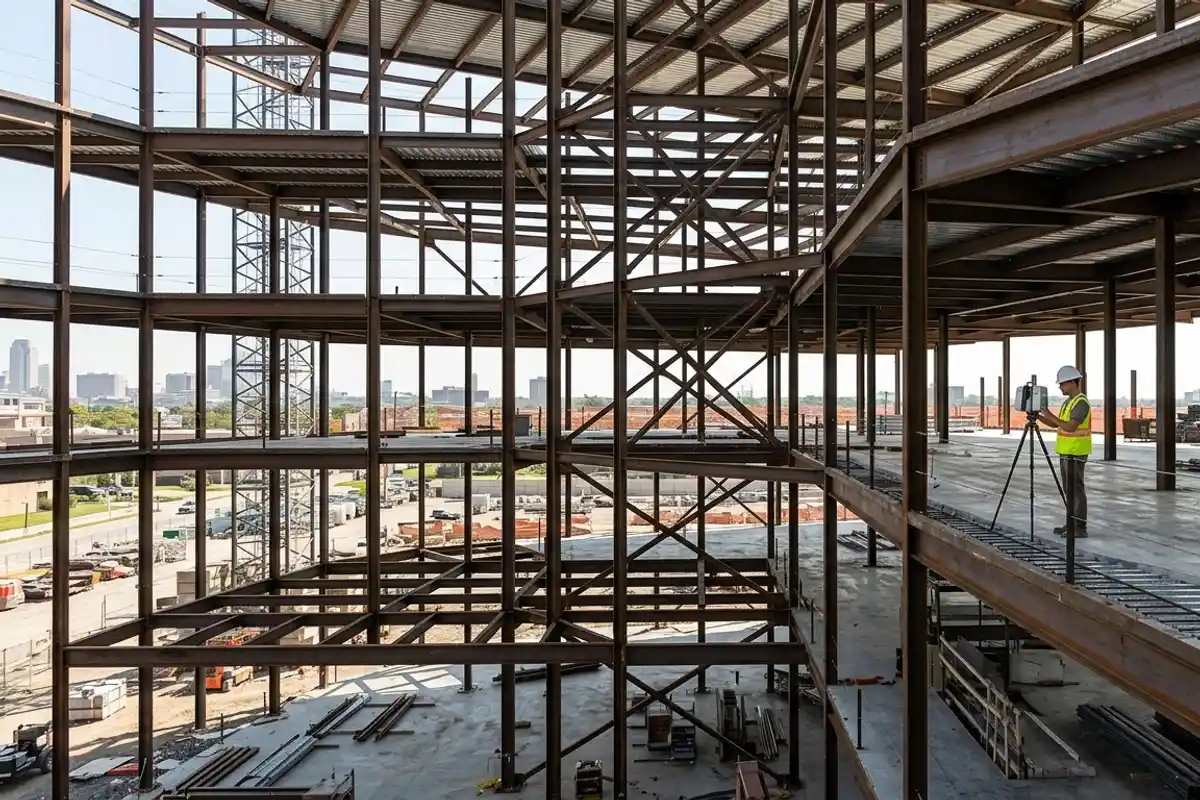
A Leica RTC360 captures the site at an accuracy of ±2 mm. We register these point clouds in Cyclone REGISTER 360 and overlay them directly onto your design model in Autodesk Navisworks. This reveals exactly where the field execution has drifted from the design. Catching a misplaced sleeve before the concrete pours, or an overhead plumbing run that encroaches on the ceiling plenum limit, prevents the tear-out costs that derail project schedules. Send us your project floor plan, and we will tell you the exact turnaround time for a structural verification scan.
When is the right time to schedule a verification scan?
The timing of your scan must align with critical construction milestones, usually right before the work is permanently concealed.
The most high-value capture points are post-tension cable layouts prior to concrete pours, open-wall MEP rough-ins before drywall closure, and structural steel framing before fireproofing. Capturing the site at these stages establishes a verified baseline for LOD 500 as-built documentation. If you wait until the drywall is up, a 3D scanner can no longer capture the complex mechanical routing inside the wall cavity. You lose the ability to prove the installation matched the design. We serve all of San Diego County, with projects across Orange County, Riverside County and the Inland Empire, scaling our mobilization to fit your critical path. Tell us your construction schedule, and we will scope the exact capture milestones your building needs.
What deliverables do you use to evaluate field deviations?
The standard deliverable is a registered point cloud in E57 or RCP format, aligned to your project shared coordinate system, alongside a deviation report.
The point cloud itself is the raw measured truth of the site. When we bring that data into Autodesk Revit or Navisworks Manage, we generate heat maps and clash reports that highlight out-of-tolerance elements. For floor flatness and levelness, we extract elevation maps directly from the sliced point cloud. This gives concrete contractors immediate feedback on the pour quality. If your site requires boundary verification during the foundation layout, our licensed California Professional Land Surveyor (PLS) partner manages the formal land surveying deliverables. For the building interior and structural framework, 3D laser scanning provides the high-density spatial data required for comprehensive scan-to-BIM verification.
When is laser scanning the wrong tool for verification?
Laser scanning fails when the objective is sub-surface inspection or tracking broad site earthwork over hundreds of acres.
A LiDAR scanner relies on line-of-sight. It cannot see through freshly poured concrete to verify rebar depth, nor can it look behind finished walls to find a missing insulation gap. For those tasks, you need ground-penetrating radar or thermal imaging. Additionally, if your only goal is calculating stockpile volumes across a massive excavation site, putting a technician on the ground with a scanner is inefficient. In those scenarios, drone surveying and inspection is the correct choice, covering large open areas much faster while still delivering actionable topographic data.