3D Virtual Tours and Visual Digital Twins for Facility Management
Visual digital twins connect 3D spatial data directly to structured facility records. By linking survey-grade laser scans with digitized O&M documents, facility managers can visually inspect site conditions and retrieve indexed asset data without traveling.
What is the difference between a 3D virtual tour and a visual digital twin?
If your facility team keeps traveling to a site just to see what a room looks like, or cannot find the records for the equipment in front of them, the right tool depends on which of those two problems you have. A 3D virtual tour provides a remote visual walkthrough of a space, while a visual digital twin connects that spatial geometry directly to your structured facility records. Facility managers use virtual tours to visually inspect site conditions without traveling, relying purely on panoramic photography. A true visual twin goes further by embedding asset data, maintenance logs, and compliance documents into a highly accurate 3D spatial environment.
We capture the baseline geometry using survey-grade instruments like the Leica RTC360, which produces high-density point clouds accurate to +/-2 mm. This millimeter-level precision ensures that the visual representation matches the true physical space. When you need to measure a ceiling clearance, verify the location of an existing MEP run, or plan a new equipment pad, the digital twin provides reliable spatial coordinates rather than just a distorted photograph. Relying on basic 360-degree cameras without LiDAR capability leaves you with a visual record that cannot be trusted for engineering measurements. Send us your floor plan and we will tell you how many scan positions the building needs to achieve full coverage.
How do visual digital twins organize scattered building records?
Visual digital twins anchor your isolated O&M manuals, warranty PDFs, and historical maintenance logs to their exact physical locations within the 3D model. Instead of searching through a disconnected digital folder hierarchy, a technician clicks on a specific pump or air handler in the virtual environment to retrieve its associated paperwork.
This spatial indexing is a core component of facility document digitization. We deploy high-volume document scanners to digitize paper archives and apply AI-assisted OCR with human verification to extract metadata. The custom RAG infrastructure links this text data to the spatial coordinates of the 3D scan. By integrating the visual model with the document archive, your maintenance team identifies the correct replacement part before they ever dispatch a technician to the physical mechanical room.
What hardware and file formats are required for a facility twin?
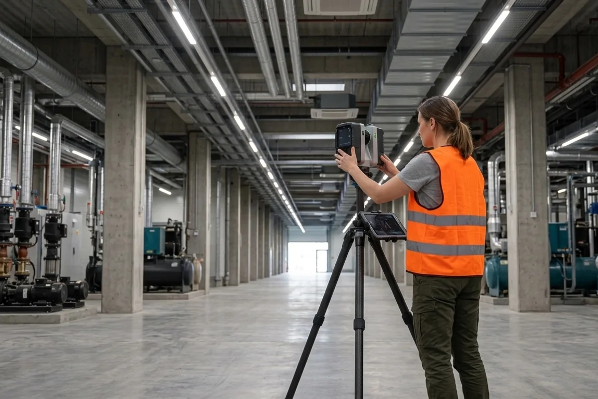
Facility twins require a baseline LiDAR point cloud in an indexed format like E57 or RCP, paired with high-resolution panoramic imagery. The raw capture relies on hardware like the Leica RTC360 or BLK360 to map the interior geometry. The scanner records millions of laser points per second, building a precise structural template of the walls, floors, and exposed systems.
Once the data is registered, it serves as the foundation for downstream engineering workflows. For teams that require parametric models, we convert these registered point clouds into Autodesk Revit models at LOD 200 through 500 through our scan-to-BIM workflow. If your team only needs to view the space and access documents, the point cloud and 360-degree photos are hosted in a lightweight web viewer. This allows stakeholders to take accurate point-to-point measurements in their web browser without installing heavy point cloud software like Cyclone REGISTER 360 PLUS. Delivering the raw E57 point cloud alongside the web viewer link ensures your engineering contractors always have the underlying raw data for future design phases.
When is a full 3D visual digital twin the wrong choice?
A visual digital twin is the wrong choice if your only requirement is locating a single equipment pad or updating a basic 2D fire evacuation route. Translating an entire mechanical room into a spatially indexed 3D environment burns budget for a problem that a simple 2D deliverable solves.
If you only need to map the footprint of a new partition wall on a flat layout, we generate a 2D AutoCAD DWG directly from a horizontal slice of the point cloud. Visual digital twins excel at complex asset management and remote multi-trade coordination. They add unnecessary overhead for a single, isolated maintenance task.
If your site involves capturing bare-earth topography for a new construction phase, a visual digital twin of the interior is entirely the wrong tool. For tracking exterior earthmoving and volumetric changes, drone surveying and inspection using photogrammetry and GNSS RTK ground control provides the right surface data. Identifying the correct digital workflow prevents you from forcing an interior scanning solution onto an exterior civil grading problem. Send us your project scope and we will define exactly which deliverables match your facility management needs without over-specifying the technology.
What factors drive the cost of developing a visual digital twin?
The total cost to capture and digitize a facility depends on the total square footage, the density of the existing mechanical systems, and the volume of legacy documents requiring digitization. Open warehouse spaces move quickly because the scanning line of sight is clear and the asset count is low. A heavily congested industrial plant takes longer because technicians must execute more scan positions to capture equipment tags and eliminate shadows behind densely packed pipes.
Pricing also scales with the condition of your existing documentation. If your facility maintenance records are already organized in clean PDF formats, linking them to the 3D space requires minimal processing. If your archives consist of decades-old paper blueprints and faded warranty binders, the project requires extensive high-volume document scanning before spatial linking can occur. Facility access rules and security clearances also impact mobilization schedules. Tell us the size of your facility and the state of your current documentation, and we will define a clear project timeline.
How does AI assist with extracting metadata for the twin?
We process legacy blueprints and specification sheets using AI-assisted OCR with human verification to categorize the text for spatial linking. The system reads the scanned manufacturer data and tags it with the correct equipment identification numbers. Processing unstructured paper records into a structured database is the hardest part of building a facility twin.
Because AI extraction is prone to hallucinating specific model numbers or misreading faded ink, our human verification step significantly minimizes extraction errors to ensure the metadata linked to the digital twin is highly reliable. The custom RAG infrastructure then allows your facility team to search the archive using natural language queries, retrieving the exact PDF associated with a clicked 3D asset. Instead of manually flipping through physical binders to find a valve specification, a facility manager can search the RAG database, locate the document, and immediately jump to that valve’s physical location in the 3D twin. We execute these digitization and 3D laser scanning workflows serving all of San Diego County, with projects across Orange County, Riverside County and the Inland Empire.