Plant and Industrial Facility Laser Scanning
Survey-grade 3D laser scanning captures complex piping, structural steel, and MEP systems in active industrial environments. High-density point clouds accurate to ±2 mm provide the foundation for safe plant retrofits, equipment installation, and clash detection.
Why is traditional as-built measurement inadequate for plants?
If your plant needs a new line, a tie-in, or a skid replacement while the existing piping keeps running, the design team needs dimensions for racks, supports, and nozzles that nobody can safely tape-measure. Old 2D blueprints do not show the stacked pipe runs, supports, and structural interferences either.
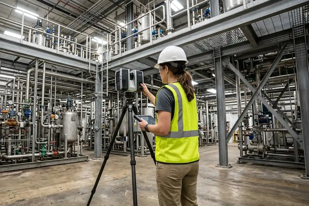
Industrial facilities change constantly. Relying on original construction drawings for a new equipment installation almost guarantees a clash in the field. Using a Leica RTC360, crews capture millions of points per second without shutting down production or requiring scaffolding. The scanner maps complex geometries including sloping pipes, structural bracing, and sagging cable trays. This delivers a complete digital record of the existing conditions accurate to ±2 mm.
When is 3D laser scanning the wrong choice for a facility?
Scanning is the wrong approach if your primary project risk involves buried infrastructure or internal material conditions.
A laser scanner only captures visible surfaces. If you need to map underground process lines running beneath a concrete slab, ground-penetrating radar is required. If your engineers need to determine the remaining wall thickness of an aging storage tank, ultrasonic testing is the correct method. A point cloud documents exactly where a pipe sits in space, but it cannot see inside or behind it. Choose 3D laser scanning to coordinate spatial geometry for retrofits, and mandate non-destructive testing for structural health assessments.
What deliverables do you provide for mechanical room retrofits?
We deliver registered point clouds in E57 or RCP format, along with 3D Revit models tailored to the specific Level of Development your team needs.
A raw point cloud is too heavy for immediate design work. We process the capture through Cyclone REGISTER 360 PLUS to tie all scan positions together into a unified coordinate system. If your mechanical engineers prefer working directly with the point cloud, we provide an indexed RCP file for Navisworks or AutoCAD. For teams requiring a solid design base, our scan-to-BIM service models the structural and MEP elements at LOD 300 or LOD 350. This creates a highly accurate 3D database where clash detection can identify pipe interferences before any fabrication begins. Send us a photograph of your mechanical room and we will tell you whether an indexed point cloud or a coordinated Revit model is the most efficient path.
Do I need LOD 400 for a plant scan-to-BIM project?
Only if your team is running prefabrication directly off the model. Specifying LOD 400 across an entire industrial facility inflates modeling hours without providing proportional value to the engineering team.
LOD 400 requires fabrication-level detail including exact flange specifications, welds, and mounting hardware. Most retrofit engineering teams only need LOD 300 for general routing and spatial planning, or LOD 350 where specific new tie-ins meet existing systems. We recommend a hybrid approach. Model the bulk of the facility at LOD 300, and elevate only the specific zones where new equipment interfaces with existing structural steel to LOD 350 or LOD 400. This keeps the modeling budget focused on the areas of highest risk. Share your proposed equipment layout plan with us, and we will scope the exact capture zones needed to verify the clearances.
How do access and safety requirements affect the capture timeline?
Confined spaces, operational shutdowns, and required safety escorts directly dictate how many scans a crew can complete in a single shift.
Capturing an active manufacturing floor requires coordination with plant managers to ensure line of sight without disrupting production. Night shifts or weekend mobilizations are often necessary for high-traffic areas. Because industrial sites frequently feature tight clearances, we deploy equipment like the Leica BLK360 to navigate catwalks and dense equipment clusters. We scale our industrial capture scopes across San Diego County, Orange County, Riverside County, and the Inland Empire based on your exact safety protocols and required mobilization phases. Certified survey deliverables (boundary, ALTA, stamped topo) are performed by our licensed California Professional Land Surveyor (PLS) partner. We also provide the land surveying coordination to align your legal boundary with your new plant reality capture data.